Ready for a better custom mapping software?
You just found it.
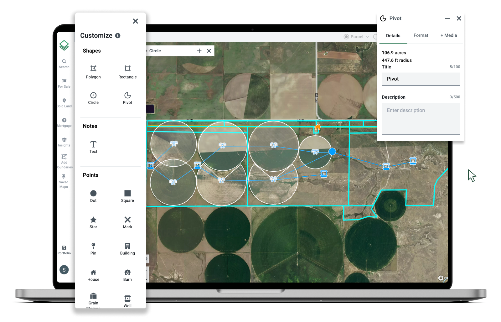
Nationwide access.
Zero hidden fees.
Get started with 2 custom maps for free, or upgrade for access to additional features, including ownership information or unlimited custom maps.
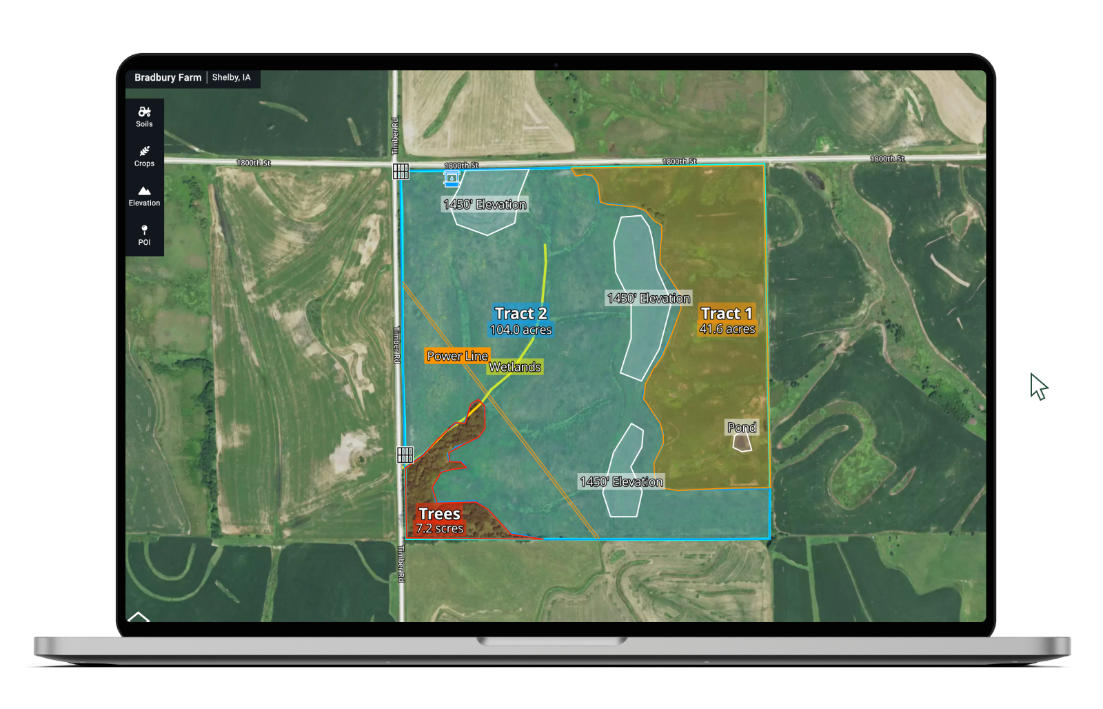
Create and share custom maps in minutes.
Edit and Merge Boundaries
Create and merge boundaries to clearly mark property lines.
Draw, Notate, and Customize
Add shapes, lines, and icons to callout key property features.
Share and Embed
Share a direct link or add a map to any website or listing.
Export to Printable PDFs
Generate a PDF report with all your customizations included.
Recommended by land professionals.
"Acres has saved me a lot of time and effort, as I no longer need to juggle between multiple mapping platforms. I highly recommend Acres to anyone in the real estate industry."
"I have been using the Acres product as a regular part of my business for almost a year now, and I wanted to let you know how great I think the Acres tool is. [...] Any agent working in the land industry should be using this tool."
Host of American Land Man Podcast Neil Hauger
Acres is the most impressive tool that I have experienced in the agricultural industry. [...] I can have data in minutes that before would take me weeks to get. Everybody I talk to in the industry, when they send me a map, I’m like, “Why’d you send me this?” and I send them a link to Acres.
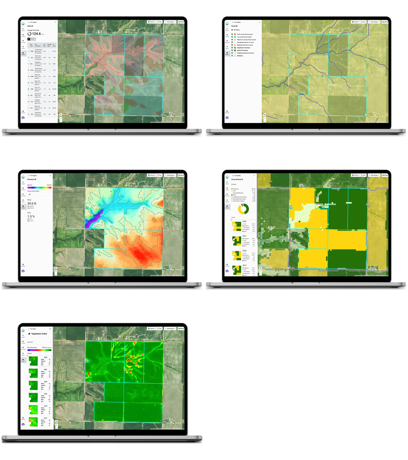
Designed for work, not just curb appeal.
Creating an interactive map is just the beginning. Acres is made to speed up your day-to-day work, like market research, creating marketing materials, or finding comparable sales.
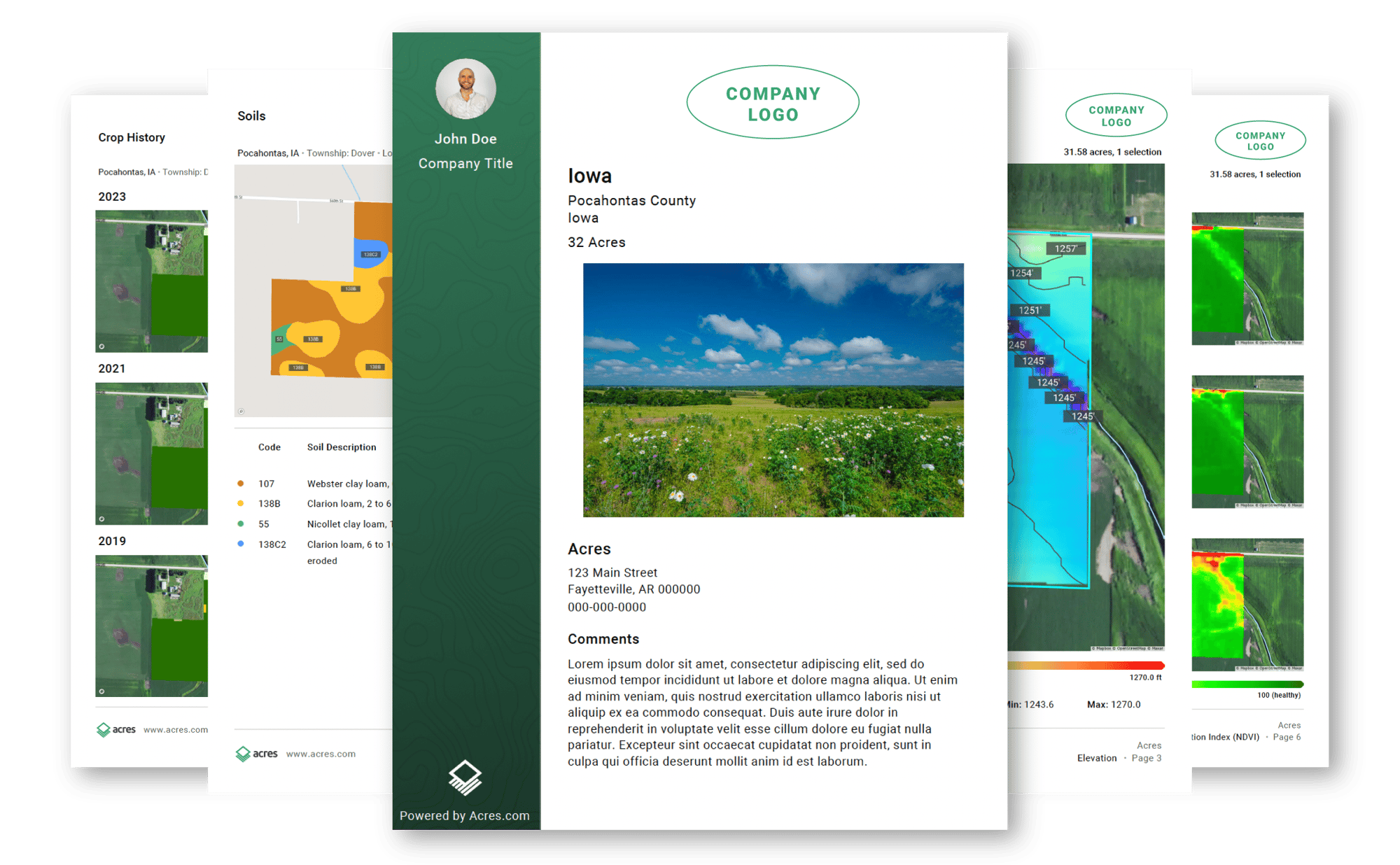
We take property reports to a new level.
A property map is more than just a guide. It’s a marketing opportunity. Add your branding and download a property report that will wow your client and showcase your expertise.
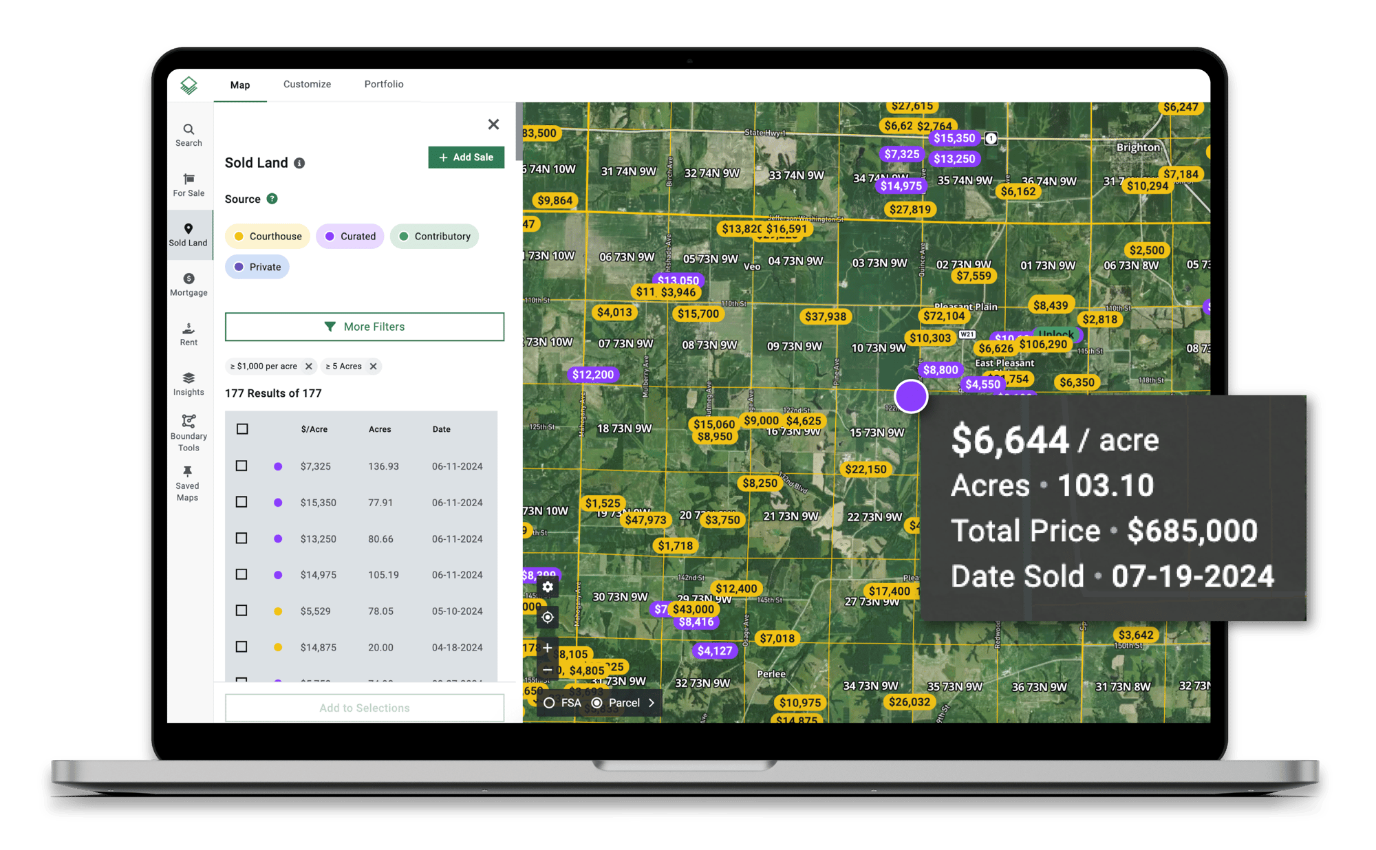
Ditch bad data and get access to accurate, national sales data.
The latest rural property sales data is critical for making informed decisions. Acres brings you high-quality, weekly updates nationwide, including data in non-disclosure and partial disclosure states.
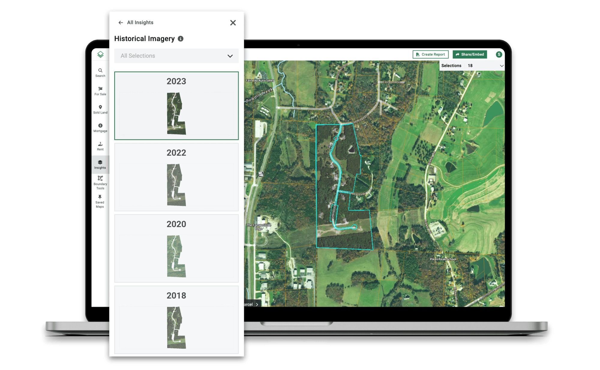
Research past land use with historic imagery.
The latest imagery only tells you so much. With Acres, you can easily click through 10+ years of historic satellite imagery, crop history, and vegetation index to understand past land use.
Everything You Need in One Place
Land for Sale
Weekly Sales Data
Custom Maps
CMA & Property Reports
Share & Embed Maps
FSA Boundaries
Portfolio & Owner Search

Ownership Information
Assessment Data
Property Lines
Soil Reports
Elevation
Crop History
Vegetation Index (NDVI)
Historic Satellite Imagery
Flood and Wetlands
Property Tax
Water Districts (CA, NE)
Bank Data
Power Grid

